
HH&F Geospatial & data solutions
Our methodology is rooted in the intersection of ecological & spatial science, client priorities, and technical practicality. Each engagement is tailored to the specific project, project objectives, and stakeholder vision — ensuring that deliverables are both actionable and sustainable.
Plot Precise Maps Of Your Land and Its Natural Resources
You have questions about your land. What exactly is there—your trees, streams, property lines, or wildlife habitats? Or maybe you’re wondering how to protect those resources while keeping your land healthy for generations to come.
Whether you manage forest, farmland, or a stretch of Appalachian ridgeline, Heritage Habitat & Forestry is here to help, with geospatial mapping that gives you the full picture.
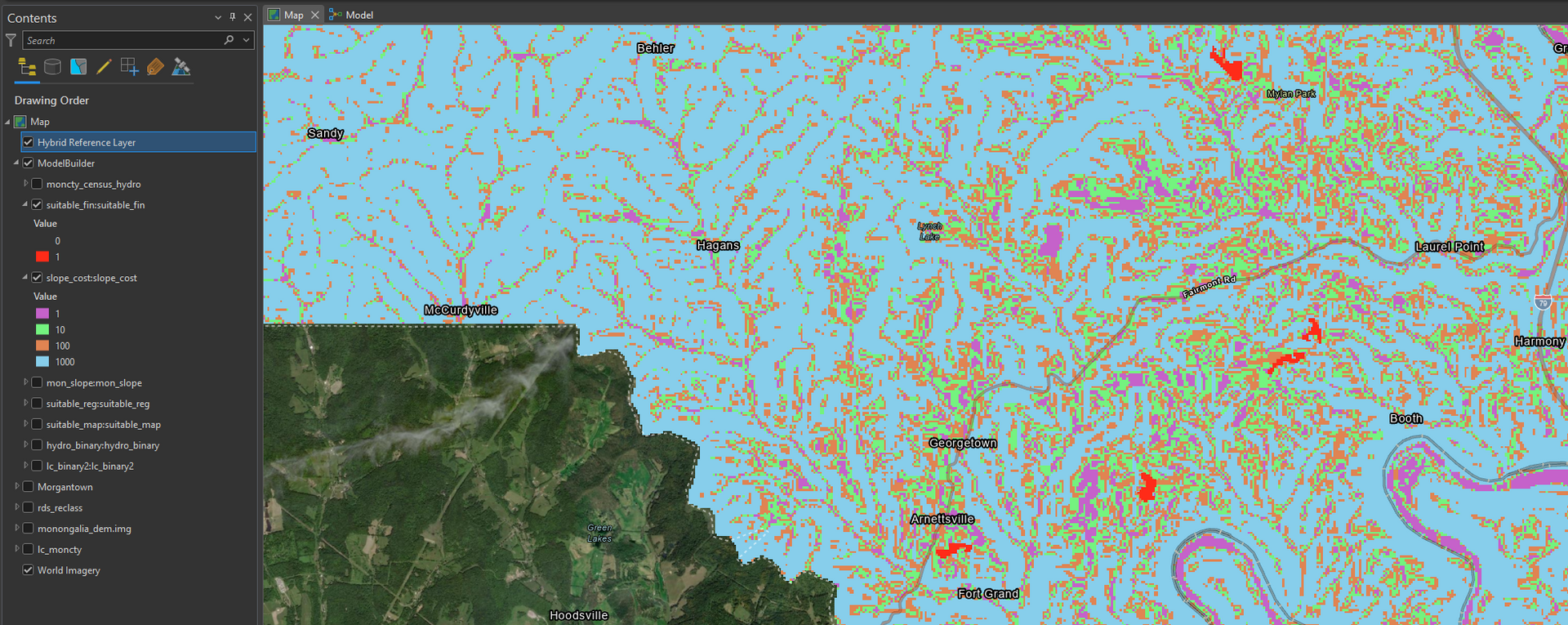
We use Light Detection and Ranging (LiDAR) and Geographic Information Systems (GIS) to map your land in vivid 3D layers—showing terrain, trees, water, property lines, and even what’s underground. With this clear, detailed view, you can make smarter decisions to manage your land and protect it.
Map What Matters Most to You
Every landscape has a story—and the right map brings that story into focus. Whether you're managing a forest, restoring a wetland, or planning a conservation project, our custom mapping services let you see your property in a whole new light.
Using industry-leading tools like
ArcGIS Pro, we tailor each map to your goals, highlighting the features that matter most—from ecological zones and habitat types to water systems and land use patterns.
Project Snippets
Get Expert Consultation and Support
Geospatial Mapping That Puts You in Control
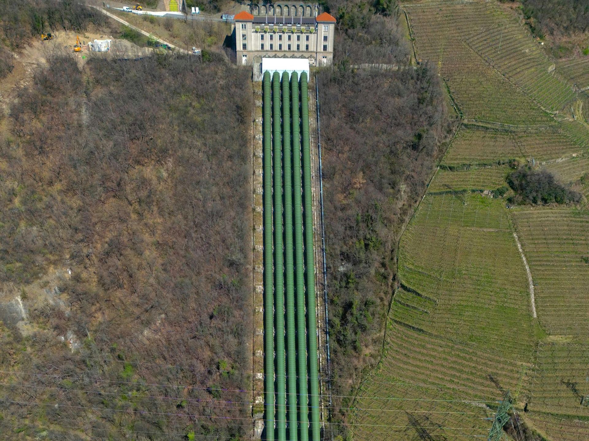
Thinking about building a road, managing timber, or restoring a stream—but unsure what’s really on (or under) your property? Geospatial mapping helps you avoid expensive surprises and make smart, sustainable choices. It gives you a full picture of your land—terrain, resources, even underground water flow. Now, you can move forward with clarity and confidence. Here's how Heritage Habitat & Forestry helps:
Know Your Land’s True Potential
Our geospatial surveying and mapping reveal critical details like soil types, water flow, and habitat areas nationwide. Understanding these local nuances helps you plan wisely and maximize your land’s value.
Map Smarter, Not Harder
Skip weeks of walking your land and guessing what’s below. Our GIS mapping services create accurate maps with layered details—property lines, vegetation, water flow—so you get the full picture and make confident decisions faster.
Mitigate Risk and Improve Efficiency
Identify threats like soil erosion that strip fertile ground and harm your habitat, or limited access points that slow work and drive up costs. With GIS in natural resource management, you gain the insight to spot and address these risks early, protecting your land and your budget.
As one of the
leading geospatial mapping companies in the region, our expert consultants don’t just deliver data — they turn it into actionable insights
tailored to your land’s unique features. You get maps that reflect your property’s complexities and a
trusted partner guiding your stewardship every step of the way.
How We Help Landowners Like You Across North America
When it comes to GIS in natural resource management, having accurate, detailed data is key. With advanced GIS mapping, you get the insights you need to unlock your land’s full potential and protect it for the long haul.
Know Where Every Tree, Stream, and Boundary Lies
From the rolling Appalachian hills to the Midwest woodlands, knowing your land’s exact boundaries, streams, and trees means you can protect your piece of home, avoid disputes, plan smartly, and keep your land healthy.
Make Informed Choices for the Long Term
With expert analysis of soil types, water flow, and habitats, our approach to GIS in water resource management helps you design projects that sustain your land’s health and support your community.
Protect the Land You Love
Spot invasive species or habitat disruption early—take action before they spread and threaten your land’s natural balance.
Take Pride in Responsible Stewardship
You care about this land. We help you manage it with confidence and respect, guiding you through every step to keep it thriving.
Turn Tech Talk into Land-Smart Action
All those acronyms? We’ll translate them into plain English, so you know exactly what tools you’re using and how they help you care for your land. But behind the jargon are powerful tools that help you understand your land like never before. Let’s break it all down so you know exactly how each one helps you protect, plan, and make smart choices for your land.
3D Modeling
using LiDAR detections, we can create, maintain, and correct individual maps in a 3D environment.
Biomass & Carbon Estimations
The quantification of the amount of carbon stored in vegetation and soil within a specific area, helping clients better understand their carbon sequestration potential for environmental management or carbon credit generation
CADD & Survey Conversions
The process of linking survey data—such as points, lines, or boundaries collected during a land or field survey—to real-world geographic coordinates. This means assigning precise latitude and longitude (or other coordinate system) values to surveyed features so they can be accurately placed on a map or integrated with geographic information systems (GIS)
Cartography
The creation of detailed, customized maps using advanced geospatial technologies to support land management, resource planning, and environmental analysis, among others
Geospatial & Data Services
Precision mapping and intelligent insights gathered from spatial distributions and relationships
GIS Database Management
The development and maintenance of geodatabases and associated maps that enable intelligent and informed decision-making
Individual Tree and Vegetation Analysis
Identifies tree species and plant life across your property. Whether you’re managing forests or protecting wildlife, this info helps you take action that supports biodiversity.
LiDAR Mapping
the delivery of high-resolution, three-dimensional representations of terrain and vegetation, essential for accurate resource assessment.
Spatial Data Analysis
the use drone technology, geospatial analysis, and remote sensing tools to capture high-resolution data for precise environmental monitoring, land assessment, and resource management
Watershed and Water Resource Insights
Reveals how water moves across your land. Prevent flooding, improve drainage, and protect clean water sources by understanding your watershed.
Custom Geospatial Solutions for Your Land
Your land is one-of-a-kind. We build custom solutions to match your goals, whether you’re managing timber, restoring habitat, or planning long-term growth.
With these tools, you’re not just getting maps—you’re gaining a clearer understanding of your land that helps you protect it, plan wisely, and enjoy it for years to come.
Trusted Technology Backed by Leading Agencies
Geospatial mapping with GIS and LiDAR isn’t just a cool tool—it’s a proven approach used every day by federal agencies to protect and manage land.
From the U.S. Fish and Wildlife Service to the National Park Service, professionals rely on this tech to manage natural resources, track ecosystems, and make informed land-use decisions.
When you work with Heritage Habitat & Forestry, you’re using the same trusted tools, tailored to your land and goals.
Who We Are
Why Choose HH&F Geospatial & Data Solutions?
By choosing HH&F Geospatial & Data Solutions, clients benefit from a blend of technological proficiency, ecological expertise, and regional insight, ensuring informed decision-making and sustainable land management. We are fully certified, independently owned, and passionate about helping clients make informed, sustainable decisions.
We're more than a mapping company—we’re a team of trusted specialists who understand this region, the science behind healthy forests, and what it takes to be a good steward of the land.
Utilization of Top Technologies
We understand that every business has unique needs. Our team of experts utilize the most current, up-to-date, cutting-edge technology to serve your needs.


Portfolio of Work

Case study 1
Crime Dot-density Map for City of Chicago
Client: City of Chicago, University of New York at Buffalo via Chris Pappas-Ford, Geospatial Manager
Location:
Remote
Scope of Work:
- Engineered advanced geospatial crime statistics maps for the city of Chicago, integrating multi-dimensional datasets.
- Analyzed and synthesized census demographics, meteorological data, and reported crime incidents to produce spatially precise dot density maps.
- Systematically classified criminal activities into violent and non-violent categories and further disaggregated by typology, such as arson, battery, and theft.
- Conducted quantitative spatial analysis to identify correlations between increased violent crime rates and warmer weather patterns in low-income areas
Outcome:
Developed probabilistic models leveraging integrated crime, climate, and population data to predict crime occurrence, temporal distributions, and spatial risk zones.

case study 2
Janus Project – Global Geospatial Mapping Initiative
Client: NV5, Maxar, Wiser via Chris Pappas-Ford, Geospatial Manager
Location: Remote
Scope of Work:
- Conducted a comprehensive spatial analysis of Earth's surface, integrating multi-modal transportation networks and terrain classifications.
- Applied high-resolution mosaic ortho-imagery to perform land cover classification, distinguishing ecological and anthropogenic features such as evergreen and deciduous forests, barren landscapes, and urban residential zones.
- Geocoded and digitized transportation corridors, including pedestrian pathways, arterial roadways, subterranean and elevated transit systems, and multi-modal infrastructure for precise spatial representation.
- Utilized advanced 3D geospatial modeling environments to process, manipulate, and refine LiDAR datasets, enabling high-fidelity terrain reconstruction and topographic analysis.
Outcome:
Created a detailed 3D map of the planet's surface using LiDAR technology, which focused on documenting Earth's current state to aid conservation, research, and future planning. Along with assisting with the Seabed 2030 Project, which seeks to map the entire ocean floor by 2030, using crowd-sourced sonar data to understand underwater topography and currents.
case study 3
Repair Underground Gas Network Project
Client: Texas Gas via Chris Pappas-Ford, Geospatial Manager
Location: Texas
Scope of Work:
- Digitized and repaired underground gas pipeline networks across Texas, with a focal study on El Paso for spatial accuracy and infrastructure resilience.
- Coordinated with field teams to integrate real-time data updates into geospatial models, enhancing dynamic workflow precision.
- Conducted detailed analysis of blueprints and as-built documentation to determine pipeline geometry, spatial location, and material characteristics for optimized asset management.
- Developed a comprehensive strategy for pipeline service optimization and network management, employing predictive geospatial methodologies to mitigate disruptions caused by winter freeze events in Texas.
Outcome:
Enhanced the underground gas pipeline network across Texas by repairing infrastructure and resolving discrepancies in pipeline data, including shell type, geometry, and location. Streamlined response processes to improve efficiency, reducing resolution times for One Gas customers experiencing utility-related issues. Created plans for upgrading and replacing old or insufficient gas lines with newer materials that met current standards for safety and capacity. This included extending the pipelines to accommodate new appliances, increasing their diameter for higher gas flow, or upgrading materials for longevity and reduced risk of leaks.
New Title
Frequently Asked Questions
Got questions? Here are clear, straightforward answers about geospatial mapping and land management.
How does LiDAR work on my land?
LiDAR (Light Detection and Ranging) uses laser pulses from a drone or aircraft to create highly detailed, 3D maps of your land’s terrain and features, like trees, hills, and waterways. It’s a precise way to “see” your property from above, revealing details you can’t easily spot on foot.
What happens with the data you collect?
We process the data into easy-to-understand maps and reports that show boundaries, vegetation, water flow, and more. You get actionable insights to help manage your land smarter, avoid costly mistakes, and plan projects with confidence.
What makes your team qualified?
Our team includes certified foresters and geospatial experts with degrees in forestry and geography, along with years of experience managing land across Appalachia and the Midwest.
Unlock the Story Your Landscape Holds
With Heritage Habitat’s geospatial mapping, you’re not just getting maps; you’re gaining peace of mind and no more guessing, no more surprises—just smart, confident choices that help your land thrive for your family, your community, and the future.
Ready to unlock the story your landscape holds?